
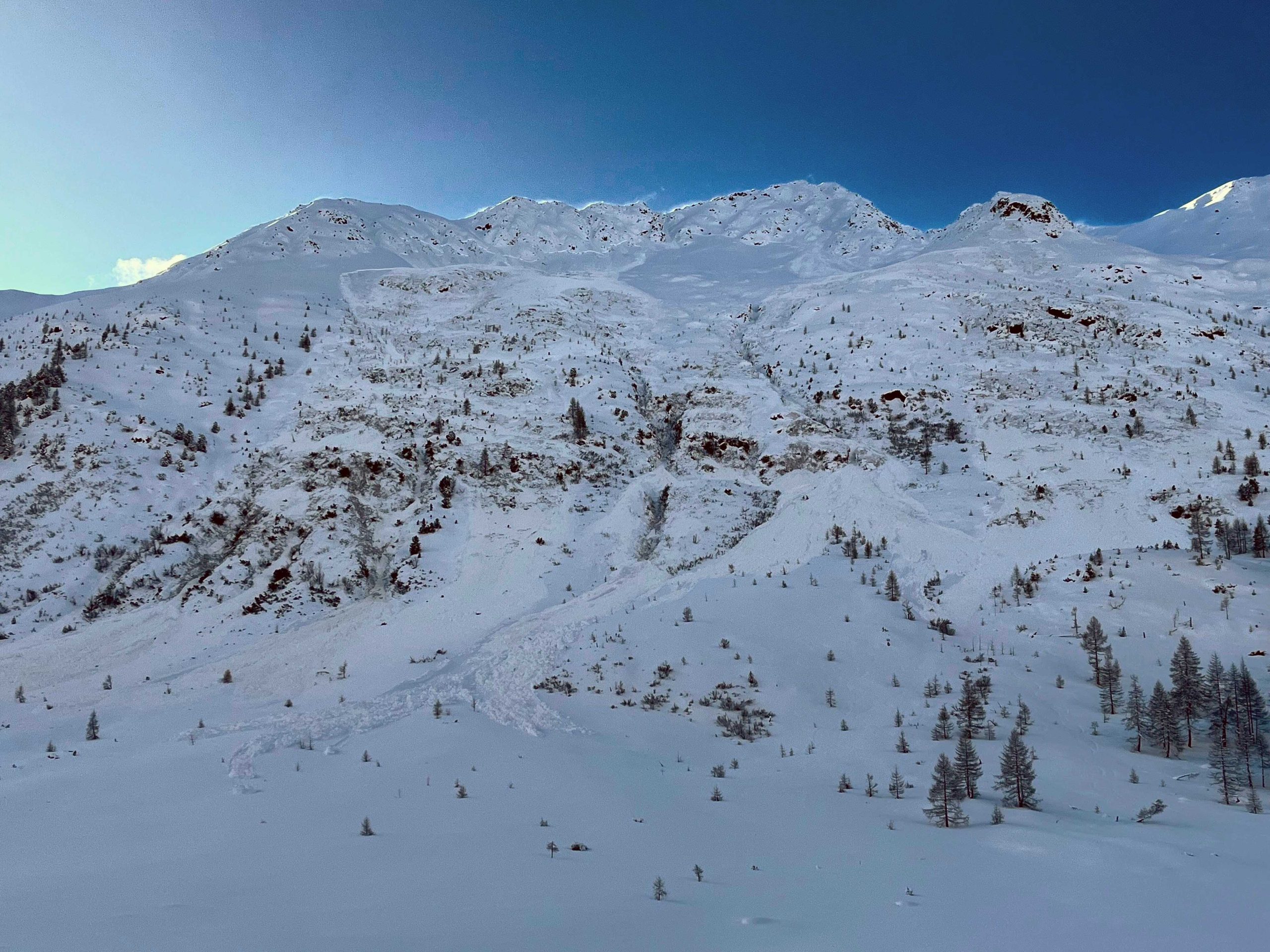
March this year was a busy month in the Austrian Alps and beyond. The lack of snow in winter meant that almost all winter sports enthusiasts were starved for powder, which is no wonder, as there were 6-7 worthwhile snowfalls in total all winter.
Anyone who has attended a serious avalanche awareness course knows that the alternation of infrequent snowfalls and prolonged good weather, as well as large temperature fluctuations, can trigger destabilising processes in the snowpack. I won't go into the process now, as it would be complex and long to describe, but this post is intended to raise awareness, together with the cover photo I recently photographed in East Tyrol.
As we had a heavy snowfall over the weekend and another front is coming on Monday, which will also bring a good amount of snow, I would like to warn you about the current situation!
What has happened so far in March?
At the beginning and in the middle of the month, there were two major snowfalls, which gave a nice kick-start to the events both in Austria and in the surrounding mountains.
I would like to share a statistic here to show you which areas are most at risk. I've looked at accidents from 1 month ago and compiled the list below to help you identify where to go in the middle of the week and which areas to watch out for.


As you can see, Tyrol and East Tyrol are the most affected regions. Not only because they received relatively the most snowfall, but also because they were the most likely to develop a weak layer (several) deeper. Unfortunately, these will be with us for the rest of the winter.
It is worth noting in the figure below that the most likely orientation for triggering an avalanche is the northern slopes. In elevation, a persistent weak layer should be expected from 2200m on the northern slopes and above 2400m in all directions. These data can be extracted from avalanche reports.


Avalanche type: we should expect slab avalanches, especially with the current strong winds. Spontaneous avalanche releases are possible early in the week, even on a large scale, as weak layers on wind-protected sites under the weight of heavy snow may also promote deeper layer releases.
I write from personal experience that at the moment the northern (north, north-east, north-west) slopes are very unstable. Before the snowfall I saw a lot of spontaneous avalanches, almost without exception on the northern slopes.
Increased attention should be paid to route choice in the coming days!
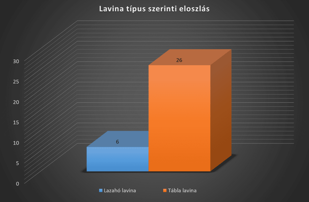

Due to the heavy snowfall, the avalanche danger has reached level 4 above 2200m, below which it is currently level 3!
I recommend a detailed study of the avalanche reports before anyone sets off! The days after the snowfall can be critical, firstly because of the high winds and heavy snowfall mentioned above, and secondly because of the warming that will follow the snowfall. The sun is very strong at this time in March, it can melt the snow immediately, making it heavier and, due to the unstable snow cover, can also cause spontaneous (even large) avalanches!
Follow this link to find out about the current avalanche situation in Austria: https://www.lawine.at/
To sum up, I recommend everyone to be patient and only start hiking or freeriding with the above in mind.
In case you didn't understand exactly what I was writing about, I recommend taking an avalanche course, either with me or elsewhere, but have a competent instructor who is internationally recognised in the subject.
If you choose me, there are 3-4 opportunities per season and you can find more information here: https://kalandozasok-ausztriaban.hu/lavina-tanfolyam/
Stay safe out there!
